- Home
- Connectivity
Connectivity
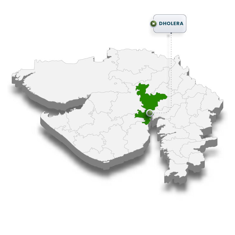
Dholera is in proximity with the coastal line. It is covered by water faces on three sides, namely, on the east face by Gulf of Khambhat, on the north side by Bavaliari creek and on southern side by Sonaria creek
Proximity to Ahmedabad has provided Dholera a strong locational advantage with a vibrant manufacturing base and investment scenario
The project is spread over an area of 35,000 hectares. The processing area which is proposed is 14,000 hectares and rest is non- processing zone
Location: Dholera Special Investment Region
Strategically located, the Ahmedabad-Dholera industrial region lies within 100 km from the Dedicated Freight Corridor (DFC) in Central Gujarat

By Road
National Highway 8 connects the Dholera Special Investment Region with Ahmedabad, Bhavnagar and Mumbai. Dholera itself has good connectivity with National Highway (NH) 8 (Anand) and 8A (Bagodra), augmenting Bagodra -Bhavnagar, Bagodra- Surendranagar- Radhanpur links
As a part of Golden Quadrilateral, the 500 km Mumbai- Ahmedabad- Vadodara Express way connects the region
Currently, two lane State Highway being expanded to 4 lanes
A dedicated 6 lane access controlled expressway connecting Ahmedabad & Dholera is proposed and design work has been completed for the same
By Railway
Rail connection is being planned for Dholera, while the nearest meter gauge connection is Bhavnagar (34 km) and the nearest broad gauge station is Tarapur (103 km)MRTS is planned which will connect DSIR with Ahmedabad
Dedicated Freight Corridor (DFC) is 1.5 hours from DSIR
Dholera Railway Station proposed in DSIR

By Airport
In order to make the region more assessable, an airport and a port are proposed in this region.
Proposed Dholera International Airport will be located in close proximity to the Northern boundary of DSIR.
Environment Clearance from MoEF and site clearance from MoCA have been obtained for developing an International Airport at Dholera.
Bhavnagar Domestic Airport and Ahmedabad International Airport are 2 hours from DSIR.
By Sea
The port site is proposed to be connected by road with Ahmedabad – Bhavnagar highway at a distance of about 11 kilometres. Almost 2,057 hectares of Government land was allocated for the development of port site.Pipavav is the closest port to DSIR, which is approximately 200 km away.
Pipavav has a range of cargo handling capabilities such as Container, Bulk, Capital Goods, Liquid, Gas, etc.
DSIR is also well connected to the major ports of Mundra and Kandla
